Wellington is the rare capital where you can finish a flat-white on the waterfront and be climbing through native bush less than 20 minutes later. The city’s compact shape, wrapped by harbour, hills and a famously bracing coastline, makes it a dream for anyone chasing walking tracks, hiking trails and easy outdoor adventures close to town.
This guide rounds up 12 of the best walks in and around Wellington, mixing classic ridgeline routes with family-friendly loops, coastal strolls, and a couple of “get out of town” day trips in the wider region. Times and distances are indicative and can change with weather, track works and your pace. Before you head out, check current conditions on Wellington City Council’s walks pages and track maps, and for regional parks use Greater Wellington’s updates.
Most Wellington tracks are free. Your main “costs” are transport, parking, and the occasional ferry ticket. Pack layers, carry water even on short walks, and treat wind warnings seriously, exposed ridgelines can turn quickly.
Best easy waterfront walk in Wellington: Oriental Bay to Waitangi Park
If you want an easy, stroller-friendly walk with prime people-watching and harbour views, start right in the city. The shared path from Te Papa along the water past Waitangi Park, Chaffers Marina, Freyberg Beach and Oriental Bay is one of Wellington’s most loved daily walks, and it suits visitors who want “views for minimal effort”.
Start point: Te Papa, 55 Cable Street, Te Aro, Wellington.
Finish point: Oriental Bay (turn around anywhere).
Distance and time: Around 4 km return if you do Te Papa to Oriental Bay and back, allow 45–90 minutes depending on stops. Cost: Free.
Best time: Calm mornings, or golden hour when the harbour turns glassy.
Local tip: For a longer city leg, keep going around Point Jerningham towards Evans Bay Parade. It’s an easy way to extend the walk without needing hills.
Practicalities: Toilets at Te Papa and along the waterfront, multiple cafés nearby, and frequent bus routes nearby. It’s a shared path, so keep left and expect runners, bikes and scooters.
Best garden walk close to town: Wellington Botanic Garden
The Wellington Botanic Garden is a choose-your-own-adventure network of paths rather than one single track, which makes it perfect for a quick lunchtime wander or a slow weekend ramble. You can stitch together viewpoints, themed gardens, and shaded gullies, all within walking distance of the CBD.
Address: 101 Glenmore Street, Kelburn, Wellington (multiple entrances, including from Bolton Street and Cable Car top station).
Time: 10 minutes to 2.5 hours depending on route. Cost: Free.
Hours: Open daily, generally dawn to dusk (café hours vary).
What you’ll see: Big specimen trees, seasonal beds, city lookouts, and a surprising sense of bushy calm for something so close to office towers.
Local tip: If you’re meeting friends, use the Cable Car entrance (280 Lambton Quay to the top station) for a scenic approach, then wander down to the city on foot.
Authority link: Wellington’s official “Top 20 Welly Walks” list includes the Botanic Garden and other favourites, see Wellington City Council’s walks guide.
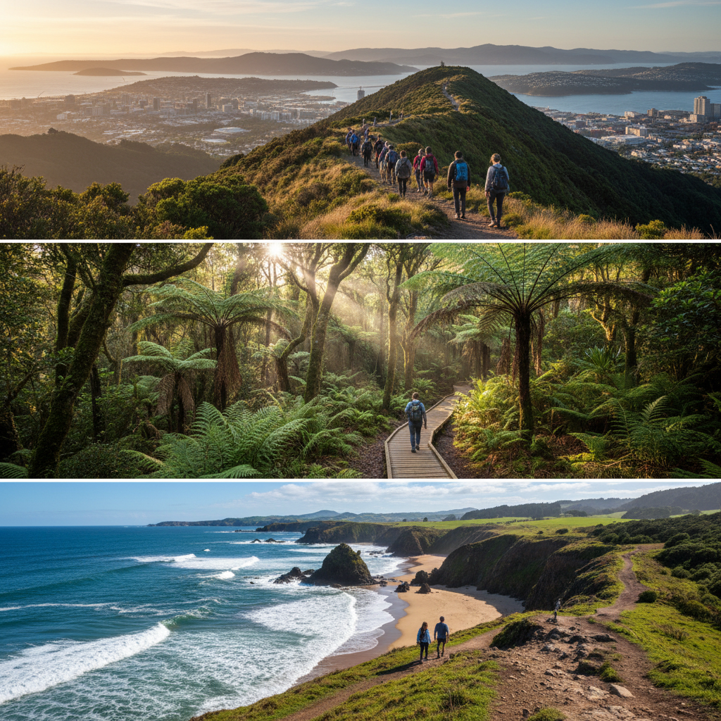
Best native bush walk in Wellington: Ōtari-Wilton’s Bush and the canopy walkway
Ōtari-Wilton’s Bush is New Zealand’s only botanic garden dedicated solely to native plants, and it’s one of the best places in Wellington for an easy-to-moderate bush fix. Short loops are great for families, while the Skyline Loop is a steeper workout for confident walkers.
Address: 160 Wilton Road, Wilton, Wellington.
Time: 30 minutes to 2.5 hours.
Key route: Skyline Loop Walk (about 4.5 km), steep and challenging in places. Cost: Free.
Hours: Open daily, daylight hours.
What you’ll see: Mature native forest pockets, birdlife, and the canopy walkway that gives a different perspective of the bush.
Local tip: After rain, expect slippery steps and roots. Shoes with good grip make a big difference here.
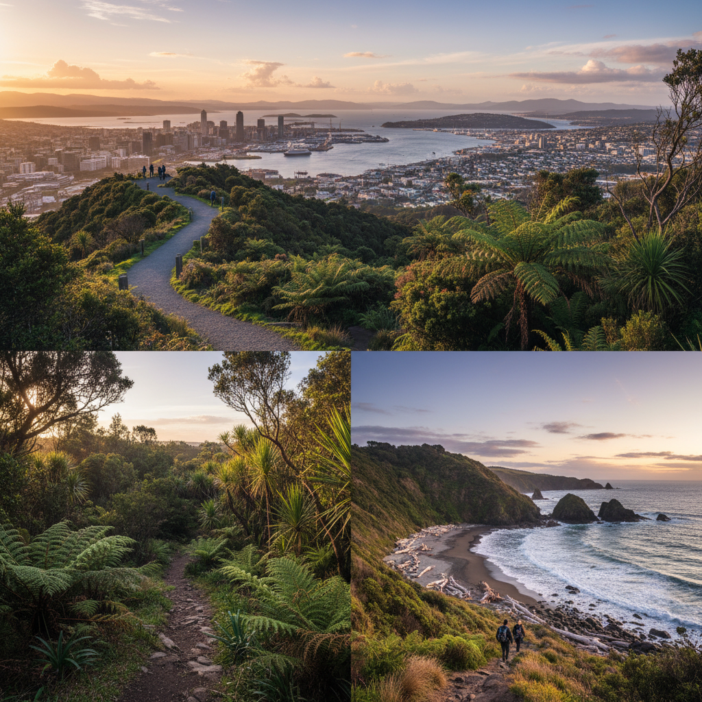
Best city ridgeline views: Te Ahumairangi Hill Loop (Tinakori Hill)
For the classic “Wellington from above” feeling without leaving town, Te Ahumairangi Hill (often still called Tinakori Hill by locals) delivers sweeping harbour and city views from regenerating bush and historic pine stands. It’s a solid half-day option that feels like proper hiking while still being close to cafés and buses.
Access: Multiple entry points from Thorndon and Northland, including near Orangi Kaupapa Road and the Zelandia fenceline area.
Time: 1.5–2 hours for the loop (add time for viewpoints). Cost: Free.
Track character: Steep in places, often exposed at the top. In northerlies, expect to work for your views.
Local tip: Pair this with a post-walk treat in Thorndon or a wander along the waterfront. If you’re building a full day in town, our ultimate guide to things to do in Wellington is a handy companion piece, and for those considering a move to the capital, The ultimate guide to moving to Dunedin: suburbs, cost of living and lifestyle offers insights into another city’s offerings.
Best coastal hike in Wellington: Eastern Walkway and Loop (Miramar Peninsula)
If you want a “proper” Wellington mix of ridgeline and coast, the Eastern Walkway across the Miramar Peninsula is a standout. You’ll get big south coast views, native bush pockets, and the option to loop back along the shoreline via Breaker Bay and Seatoun. It’s exposed and can feel wild even on a sunny day.
Access: Common starts include near Waitangi Park area (longer) or Miramar/Seatoun access points for shorter versions. The official Wellington City Council page is the best place for current track notes.
Time: About 2 hours for the core walkway, longer if you add coastal legs. Cost: Free.
What to know: There are steep sections and it can be windy. The coastline section near Breaker Bay is known for clothing-optional sunbathing, so be prepared for that if you’re walking with kids.
Local tip: Finish in Seatoun for fish and chips, or bring a snack and stop at one of the lookout points for a sit-down with a view.
Best short walk with history: Te Ara o Ngā Tūpuna heritage trail (waterfront)
Not every great “walk” is about elevation. Te Ara o Ngā Tūpuna, the Trail of our Ancestors, is a meaningful waterfront route that layers Wellington’s harbour-edge scenery with marked heritage stations. It’s ideal if you have visitors in town who want context as well as fresh air.
Route: From Pipitea Pā to Te Aro Pā and Waitangi Park, with nine marked stations.
Time: About 2 hours at an unhurried pace. Cost: Free.
Practicalities: Flat and accessible, close to public transport, and easy to break into smaller segments.
Best island day trip walk: Matiu/Somes Island Loop Track
For a walk that feels like you’ve left the city entirely, hop on the ferry to Matiu/Somes Island. The island is pest-free and a haven for threatened species, with good quality tracks that let you circuit the island and visit historic sites. It’s a classic Wellington day out, and it’s also one of the best options for kids who need an “adventure factor”.
Access: Ferry from Wellington waterfront (check timetables and booking with the operator).
Time: 2–3 hours for the loop track, plus ferry time.
Cost: Ferry fare varies by season and operator.
Hours: Open daily, subject to ferry access and conditions.
What to know: There’s a biosecurity check before you go to help keep the island pest-free. Bring your own water and food, and take rubbish back with you.
Authority link: DOC has the official track details here: Matiu/Somes Island Loop Track.
Best family-friendly regional park walk: Whitireia Park loop (Porirua)
Just north of the city, Whitireia Park is an easy win for sweeping harbour views, open headlands and beaches, with a loop that suits most fitness levels. It’s a great “first hike” for families wanting something more than a flat path, without committing to an all-day mission.
Access: Whitireia Park, Porirua, commonly accessed from the end of Onepoto Road.
Time: Around 1.5–2 hours for a loop, depending on route choices. Cost: Free.
Wildlife note: Keep dogs on lead around nesting areas. This is a known little blue penguin (kororā) zone in parts, and it’s worth walking quietly and giving wildlife space.
Local connection: If you like community events that take on rugged terrain, the Porirua Grand Traverse is a reminder that locals love a challenge, see Hundreds to brave elements in Porirua Grand Traverse.
Best river and swingbridge walk: Kaitoke Regional Park (Pakuratahi River)
Kaitoke Regional Park, near Upper Hutt, is the go-to for lush river tracks, swingbridges and towering forest. It’s also famous as a Lord of the Rings filming location, which makes it a fun option for visitors who want an easy bush walk with a bit of pop culture sprinkled in.
Address: Kaitoke Regional Park, Waterworks Road, Kaitoke, Upper Hutt (follow signs to the main carparks and campground area).
Suggested walk: Pakuratahi River Walk and Swingbridge Loop (easy, about 1–1.5 hours).
Cost: Park entry is free, camping fees apply if you stay overnight.
Facilities: Toilets and picnic spots near main areas.
Local tip: This is a strong winter option because the forest offers shelter. After heavy rain, check river levels and track notices.
Best fitness climb near Lower Hutt: Te Whiti Riser (Hutt Valley)
If you want a sweat and a view, Te Whiti Riser is a local favourite in the Hutt Valley. It’s a steep, direct climb that rewards you with big panoramas, and it’s popular with runners and walkers training for events. It’s also a good choice when you want a solid workout without a long drive.
Access: Start points vary, commonly from the Hutt Valley side in the Te Whiti area (check Greater Wellington / trail resources for the latest access and track status).
Time: Allow 1.5–3 hours return depending on pace and how far you go. Cost: Free.
Track character: Exposed and steep, take sun protection and more water than you think you need.
Best sheltered bush loop for windy days: Tane’s Track, Tunnel Gully
When Wellington is doing its classic thing outside, Tunnel Gully can be a calmer option. Tane’s Track is described as a leisurely one-hour route through native bush, with forest atmosphere and a few points of interest tied to the area’s rail history.
Access: Tunnel Gully, Hutt Valley (carpark at Tunnel Gully Recreation Area).
Time: About 1 hour for the loop. Cost: Free.
What you’ll see: A mix of native forest, streams, and remnants of earlier transport routes through the valley.
Local tip: If fuel prices and transport costs have you thinking closer-to-home, it’s worth keeping an eye on the bigger conversation about getting around the region, see Greater Wellington warns of transport cuts as fuel prices surge.
Best short walk with a fortress and views: Wrights Hill Loop (Karori)
Wrights Hill is a quick-hit hill walk with a point of difference, a WWII military fortress tucked into the hilltop. It’s a good option when you want views and history without committing to a full-day tramp, and it’s close enough to the city to do on an after-work summer evening.
Access: Wrights Hill Reserve, Karori, Wellington (check the Wellington City Council page for recommended entry points).
Time: 45 minutes to 1.5 hours depending on which loop you choose.
Cost: Free for the walk, fortress tours have separate pricing when available.
Conditions: Mostly sheltered, exposed in parts.
Local tip: Keep an eye out for native birds spilling over from nearby Zealandia, especially in quieter times of day.
Best longer coastal wild-feeling day out: Red Rocks (Pariwhero) and the south coast
Ask locals for a coastal stomp and many will point you to the south coast towards Red Rocks. It’s rugged, often windy, and feels like the edge of the world despite being close to the city. It’s a great pick if you love rocky shorelines, big skies and the kind of weather that changes your plans in real time.
Access: Common start from Owhiro Bay Parade area (follow coast track towards Red Rocks).
Time: Allow 2–3 hours return to Red Rocks, longer if you explore further. Cost: Free.
Wildlife note: In winter you may see seals hauled out. Give them space, keep dogs controlled, and follow signage.
Local tip: This track is very exposed. If MetService is forecasting severe wind, choose an inland bush loop instead.
Outdoor activities in Wellington beyond walking (quick ideas)
If you’re building a full weekend around the outdoors, Wellington makes it easy to mix walks with other low-fuss activities.
- Mountain biking: Makara Peak Mountain Bike Park (various trailheads, free entry, check trail status online).
- Swimming and beach time: Oriental Bay in summer, plus the south coast on calmer days.
- Wildlife encounters: Zealandia (ticketed sanctuary) pairs well with nearby hill tracks.
- Ferry-based adventures: Matiu/Somes Island for walking, or harbour cruises in season.
If your crew likes to finish an outdoors day with something social, you could fold in the city’s hospitality scene. For a different kind of “trail”, see our story on Wellington launches Gin Trail to support local hospitality.
Cross-site inspiration: If you’re planning trips beyond the region, it’s interesting to compare how other places structure their activity lists, like this roundup of Esperance camping guide: 15 best campgrounds and free camping spots.
How to choose the right Wellington walk for your day
If it’s howling: Pick sheltered bush, like Ōtari-Wilton’s Bush or Tunnel Gully, and avoid exposed ridgelines.
If you’ve got kids: Waterfront paths, Botanic Garden, Kaitoke swingbridge loops, or Matiu/Somes Island for adventure.
If you want views fast: Te Ahumairangi Hill or Wrights Hill deliver city panoramas without long drives.
If you want coast: Eastern Walkway or the south coast to Red Rocks.
Safety basics: Wellington weather changes quickly. Take a layer even in summer, carry water, and let someone know where you’re going for longer routes. For remote-feeling coastal tracks, turn back early if conditions worsen.


